
Drone Construction Progress Monitoring
Historically, most aerial views of construction sites were obtained through helicopter photography. This method has proven to be time-consuming, expensive, and inefficient, and as a result, the use of unmanned aerial vehicles (UAVs), or drones, is rapidly gaining popularity as a highly-effective alternative method of construction monitoring.
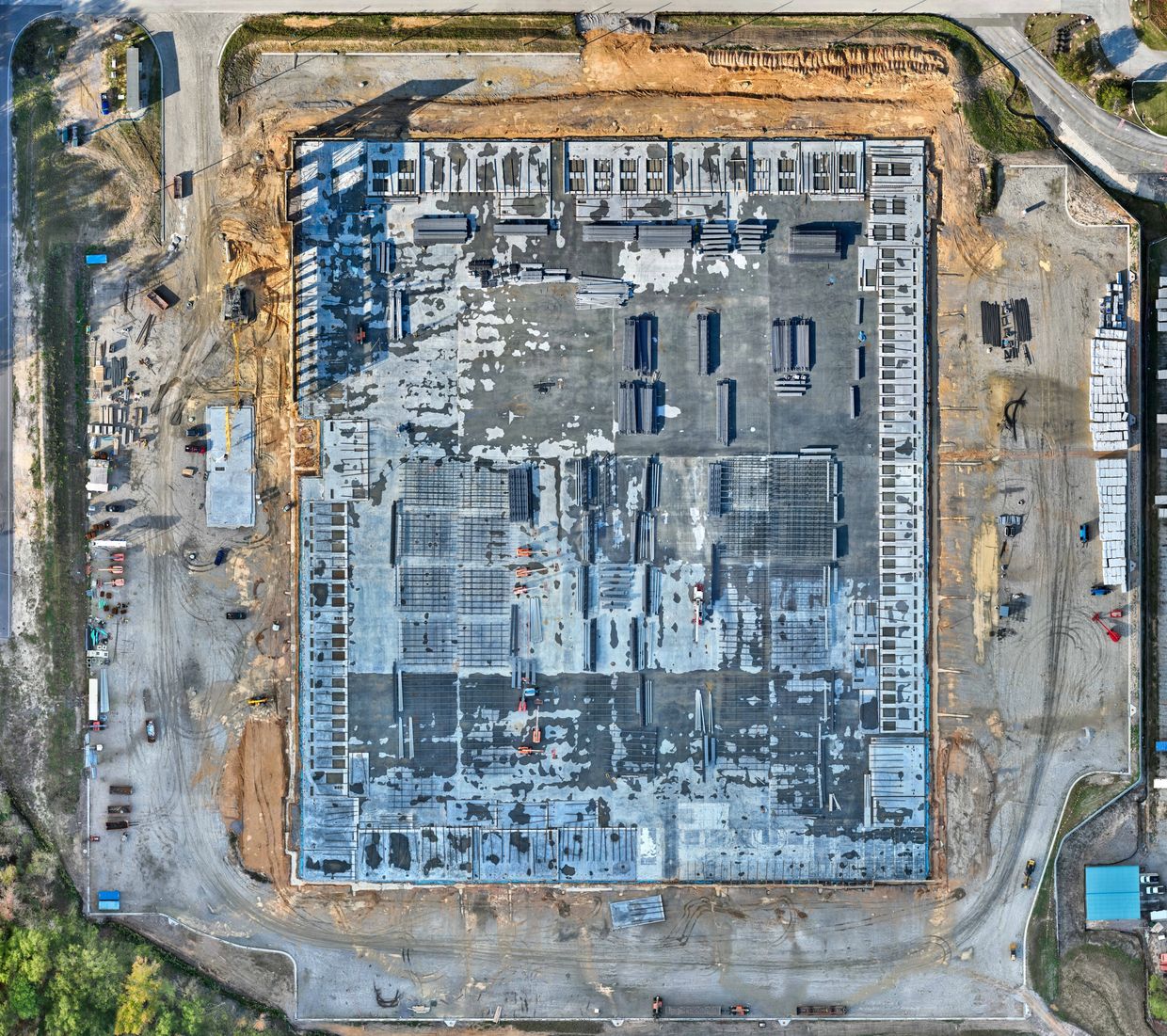
Drones controlled by an experienced pilot can be flown high above the job site, sending real-time information to the engineers and project managers on the ground. At the same time, UAVs collect high-resolution images that can then be used by licensed surveyors and mappers to create 3D models. Crucially, drones can fly close to the construction area, providing close-up shots of multiple areas around the jobsite.
Using Drones for Construction Project Monitoring
Historically, most aerial views of construction sites were obtained through helicopter photography. This method has proven to be time-consuming, expensive, and inefficient, and as a result, the use of unmanned aerial vehicles (UAVs), or drones, is rapidly gaining popularity as a highly-effective alternative method of construction monitoring.
Drones controlled by an experienced pilot can be flown high above the job site, sending real-time information to the engineers and project managers on the ground. At the same time, UAVs collect high-resolution images that can then be used by licensed surveyors and mappers to create 3D models. Crucially, drones can fly close to the construction area, providing close-up shots of multiple areas around the jobsite.
Construction companies and developers have used drone construction progress monitoring for:
- Using RTK for all Ortho Maps
- Horizontal: 1 cm+ 1 ppm(RMS)
- Vertical: 2 cm+ 1 ppm(RMS)
- Regularly tracking development and progress.
- Creating 360° views of the job site.
- Conducting comprehensive safety inspections and quality assurance to ensure safety and compliance with building codes.
- Turning data into 3D models to provide investors with a realistic look at the project.
- Creating CAD overlays to ensure the project is aligning with design plans.
- Keeping track of job site inventory.
- Proactively identifying areas where structural integrity may be a concern.
RTK Enabled Drones
RTK stands for real-time kinematic. The goal of RTK is to correct GPS location data in real-time while the drone is flying over and surveying the chosen area.
The RTK data can be this precise. RTK is the same GPS signal, but it can provide an absolute accuracy of 1 centimeter instead of meters.